

-
Part 1: Training a Walkability Index Machine Learning Model from OpenStreetMap derived data
-
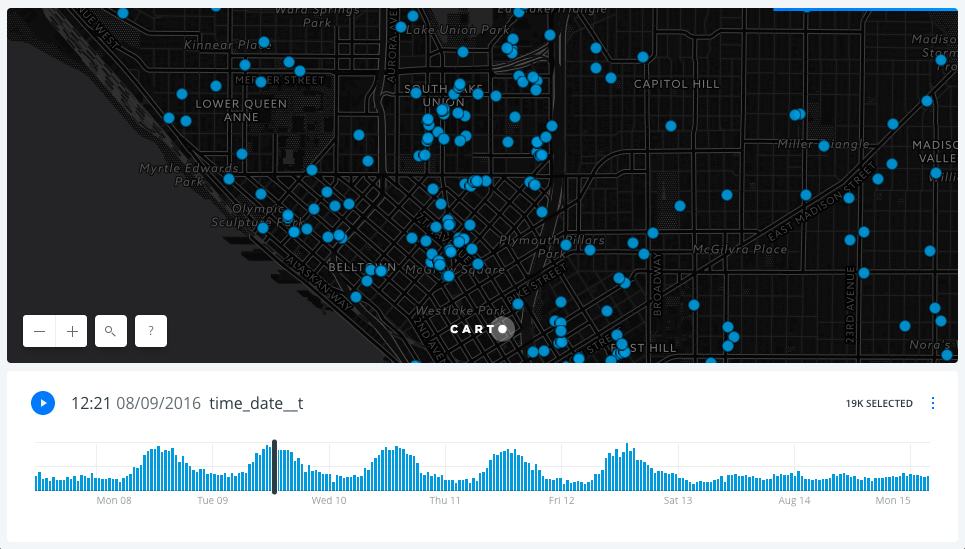
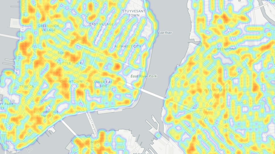
A Week of Car2Go Locations in Seattle with CARTO Builder
-
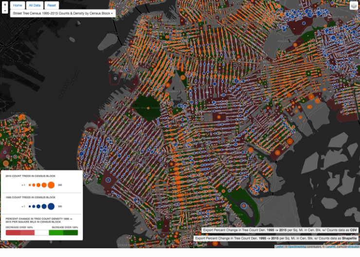
NYC Parks TreesCount! Data Jam 2016: Change over Time Category Winner
-
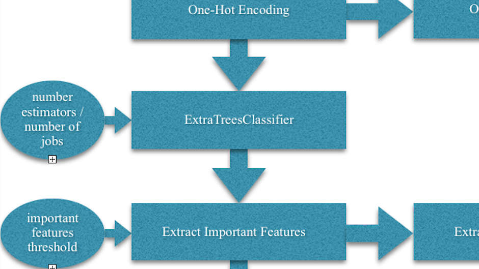
Machine Learning Course Paper: Predicting Coreference labels from Spoken Dialogue Tasks with Machine Learning: One-Hot Encoding and Feature Importances using Extremely Randomized Trees
-
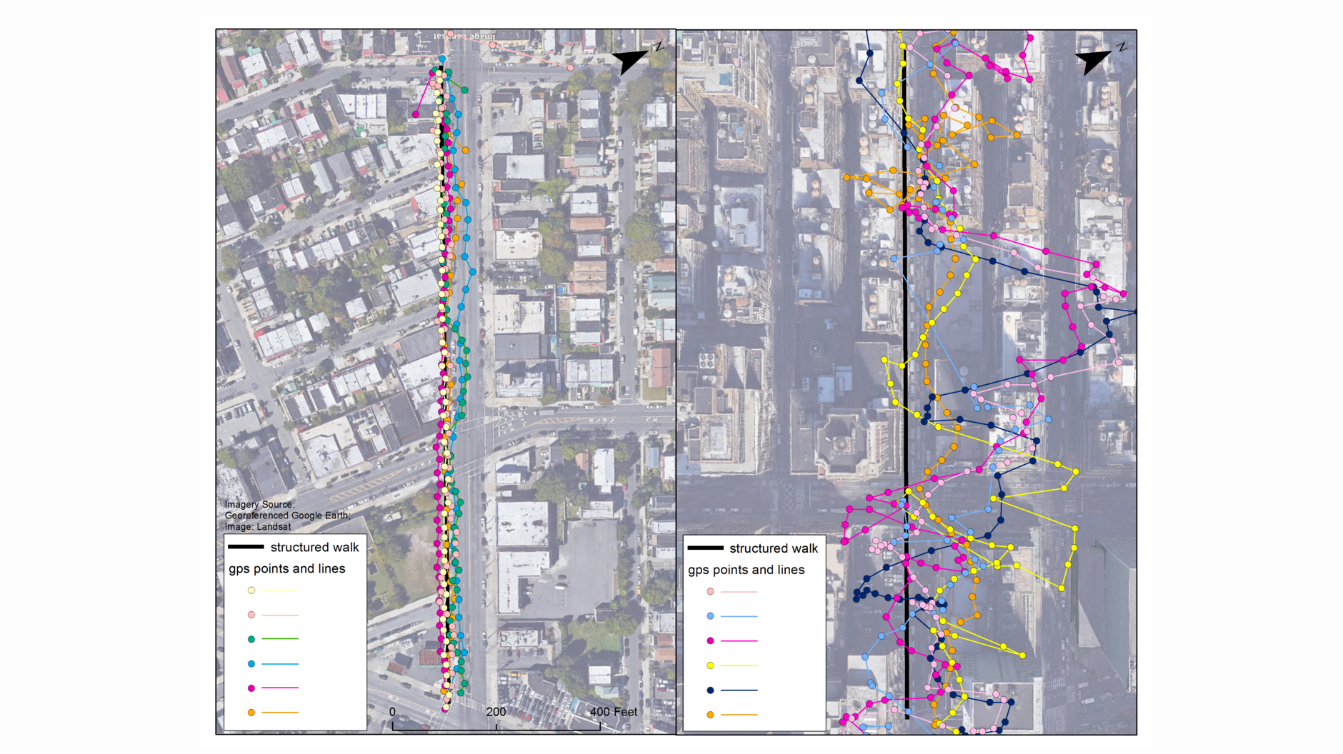
About our paper: Quantifying Distance Overestimation From Global Positioning System in Urban Spaces
-
First thoughts on ArcGIS Pro
-
Books on JavaScript, jQuery, HTML and CSS
-
2016 Goals for GIS, web and myself
-
Best Music of 2015
-
Evaluating 2015 Goals
-
Algorithms for Data Science - HW4 - NP Complete and PuLP
-
GIS Courses at Columbia University (Spring 2016)
-
Tutorial - Deploying a Flask application on AWS
-
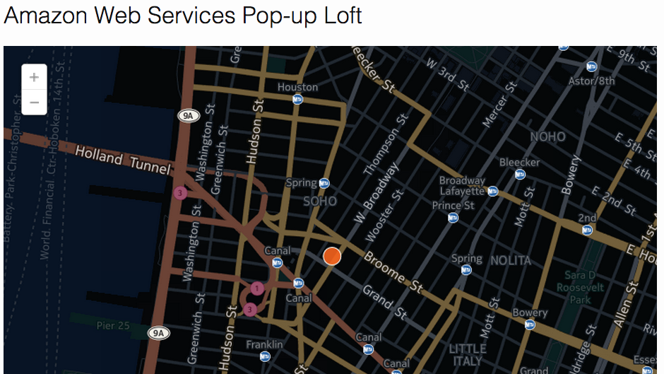
Getting Started with AWS (Amazon Web Services) - free bootcamp class at the AWS Loft in NYC
-
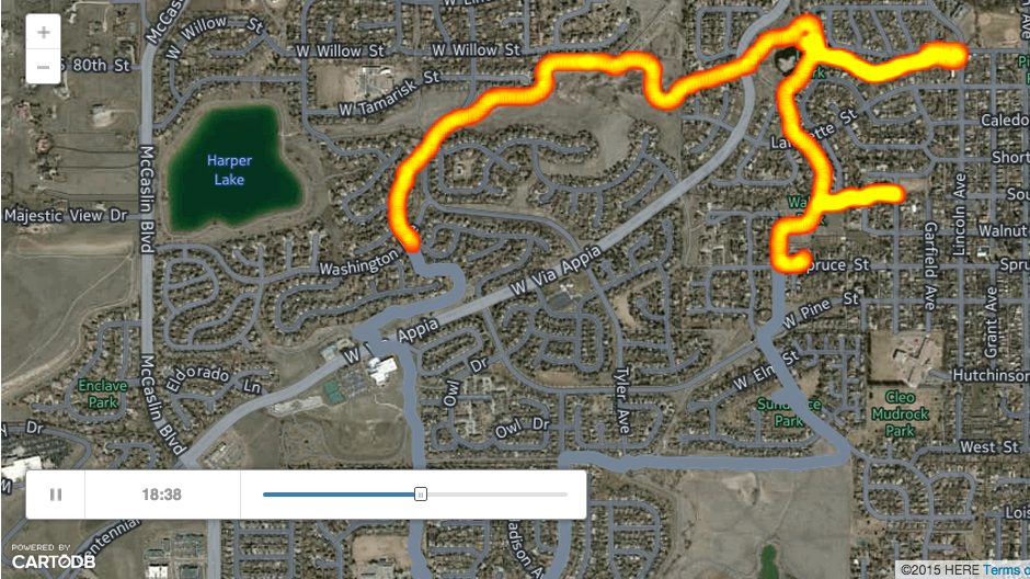
Viewing Your RunKeeper Data in CartoDB
-
Installing PostGIS (PostgreSQL) on Amazon Web Services (RDS)
-
PostGIS Geoprocessing with SQL in CartoDB-Buffer
-
Getting Lat, Lng from Jetblue FlyFi
-
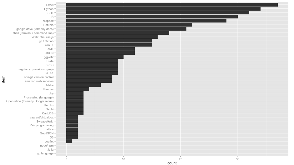
Thoughts from State of the Map US (#SOTMUS) Post 1 of 2
-
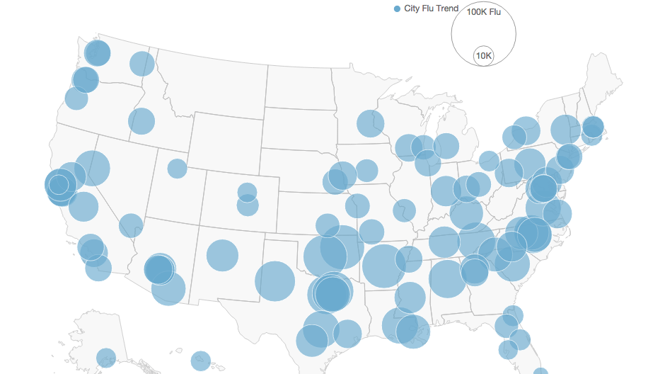
D3 Mapping with Google Flu Trends Data and Shapefile conversion to TopoJSON/GeoJSON
-
New York City Collisions Data-IPython Notebook and Plotting in CartoDB
-
Wall Street Journal Mapping the Bacteria in New York’s Subways Data
-
Using IPython Notebook with Pandas and exporting to Markdown
-
Plotting Exploratory Data Analysis and Visualization Class Skills in RStudio
-
Exploratory Data Analysis and Visualization Course
-
Updated and Additional 2015 Goals
-
Presentation: Intro to Processing for Spatial Data Viz
-
Jekyll blog rollout 2015 Goal unlocked!
-
Best Music of 2014
-
2015 Goals for GIS (geospatial) and Web
-
Welcome to Jekyll!
-
Open Source GIS Course at Hunter College this January (2015)
-
Maptime SQL for CartoDB
-
Mapbox Source Quickstart
-
Open Source Intersect - Shapely (and an OGR solution)
-
What I've been up to...
-
CSV to Shapefile conversion with Pandas, Fiona and Shapely
-
Converting File Geodatabase (FGDB) to Shapefile or CSV via OSGEO4W with OGR2OGR
-
Beginning the Columbia University IDSE Data Science Certificate Program
-
Earlier Blog Posts
subscribe via RSS